Our Mission is to support community-based emergency response on Orcas Island and in San Juan County, Washington State.
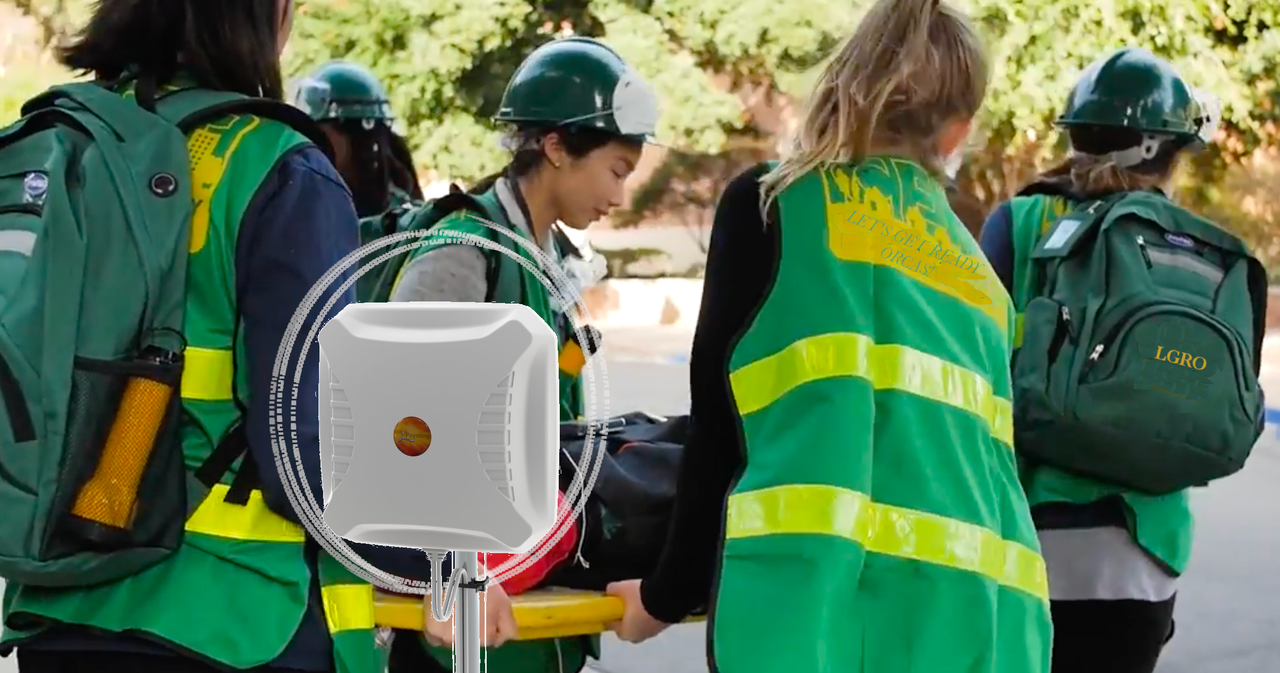
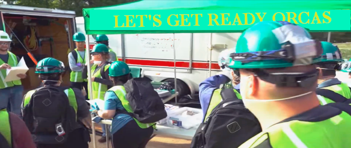
Above: A Community Responds
Let's
GET READY ORCAS!
CONTACT US
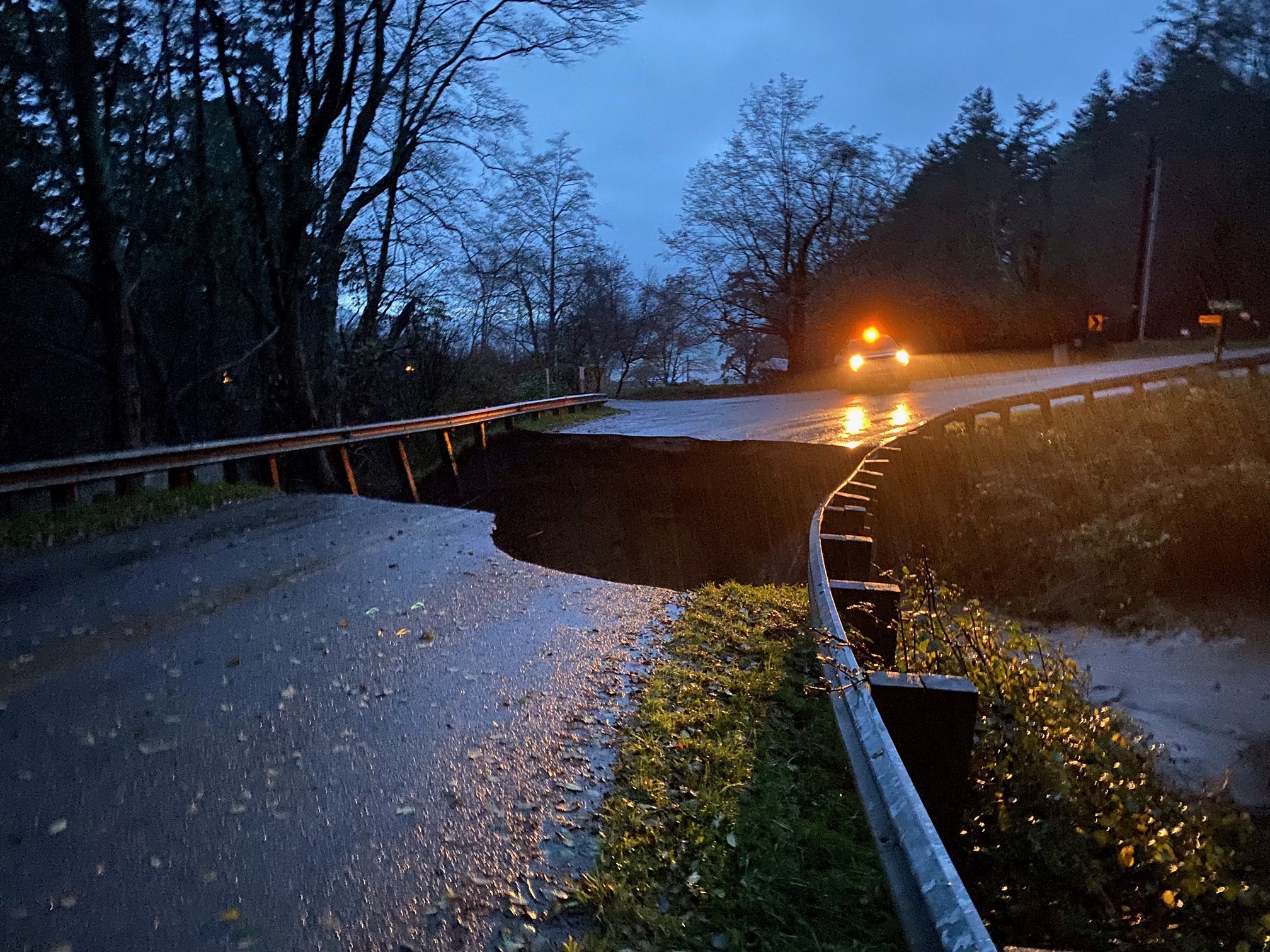
Above: Heavy rains washed away a stream bank, collapsing an island road
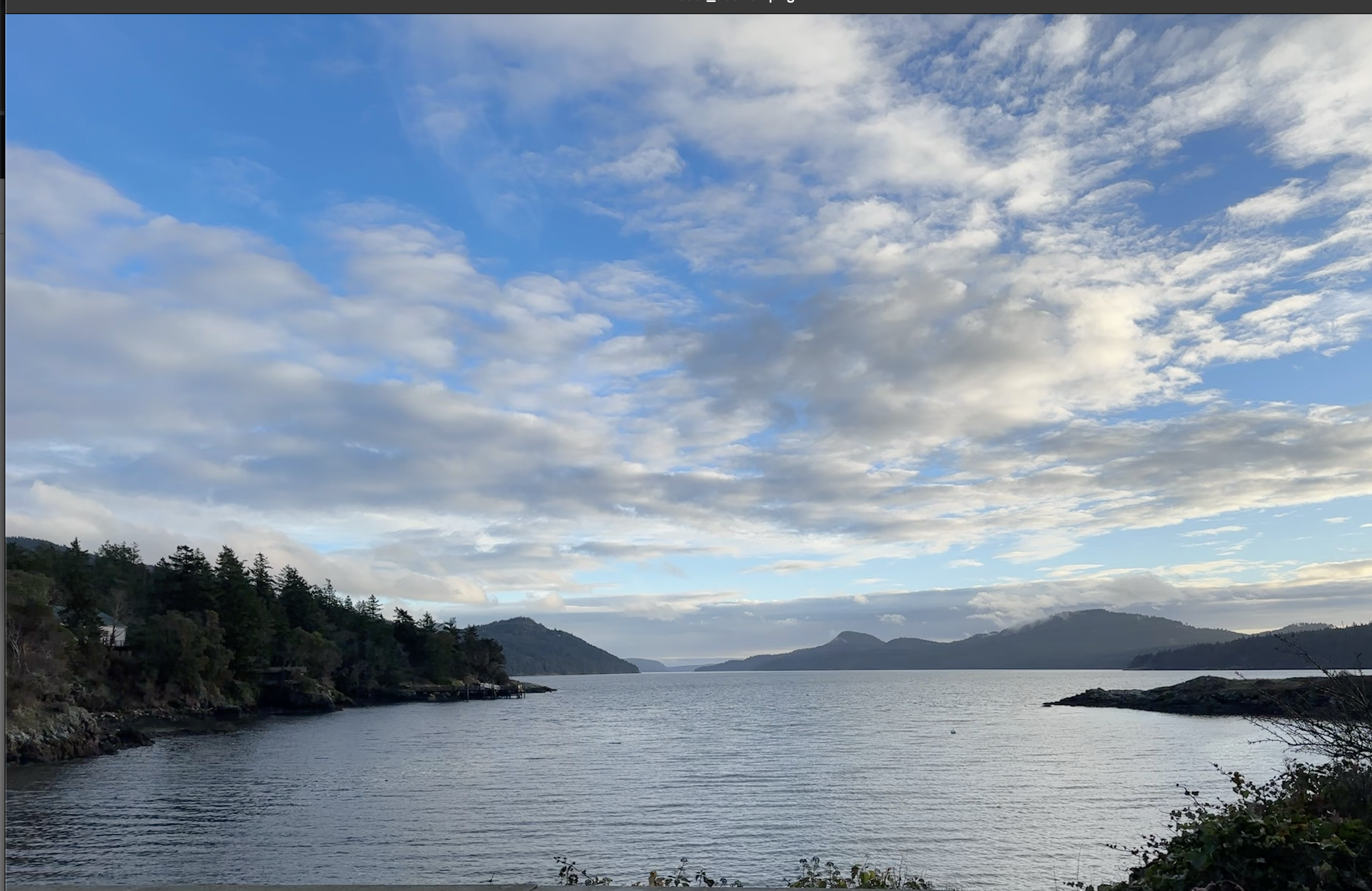
Above: The East Sound on Orcas
The island is relatively safe:
- Wildfire: Moderate summer temperatures and high relative humidity make the danger of wildfire lower than in many mainland areas.
- Flooding: The San Juans, in the rain shadow of the Olympic Mountains, get substantially less precipitation than nearby places such as Seattle. Orcas Island terrain tends to be hilly, and there are no major rivers. These factors combine to make flooding much less of a problem on Orcas than in many areas on the mainland.
- Weather events: Historically, summertime high temperatures have been around 70°F, while wintertime lows averaged in the high 30s to low 40s. Winter snows are infrequent, except at higher elevations.
- Tsunamis: The typical high bank shoreline offers significant protection from tsunamis. Generally, islanders can escape to high ground from lower areas.
- Earthquake: The prevalence of bedrock provides protection against earthquake damage, compared with other areas with more loose, unconsolidated soils.
There are still significant dangers:
- Earthquakes & Tsunamis: Though rare, major earthquakes and subsequent tsunamis will present serious challenges, even if their main effects hit elsewhere in the region. Supplies of food and fuel to the islands will be disrupted. Water pipes and water towers may crumble or crack. Many roads will be damaged. Fallen trees will block passage. Subsea power, phone and internet cables may be knocked out. Power, communications, ferries, and sewer would all be affected. In addition, in a widespread regional event, major population centers like Seattle will be the initial focus for rescue efforts. It could be weeks or months before outside help arrives in the San Juan Islands.
- Wildfire: Summers are getting drier and hotter. Each year there are periods of high fire danger, and both populated and forested areas may be vulnerable. Every 10-15 years, very strong dry winds out of the east create conditions in which a spark from a rock struck by a chainsaw or a weed whacker can ignite a wildfire.
- Winter Storms: The island is seeing increasing rainfall and more severe windstorms during the winter, along with occasional snowstorms and freezing temperatures. Roads can be blocked, power, water and electricity disrupted. Local emergency personnel have to prioritize the most severe injuries and may not reach some areas for days after a major storm.
LINKS
- Avoiding wildfires in the islands | A quick refresher (July 1st, 2026, Orcasonian)
- Dave Halloran, Assistant Director, San Juan County Department of Emergency Management (office on Orcas Island) – and DEM page on sanjuancountywa.gov
- Orcas Island Fire & Rescue (on Orcas Island Chamber of Commerce site) – and OIFR's own website
- Emergency Preparedness document created by Orcas Highlands in 2018
- San Juan County Department of Emergency management site for individual and community preparedness: islandsready.org
- Youtube video on using GMRS and ham radio for emergencies (John Beaston):
SnoVARC Integrating GMRS and Ham for Emergency Communications Presentation 09/05/24 - Slides for above presentation (5MB PDF).
- Red Cross
- San Juan County Amateur Radio Society (SJCARS)
- Federal Emergency Management Agency Community Emergency Response Team
- Washington Voluntary Organizations Active in Disaster
- WA State "Serve Washington" Community Emergency Response Team (CERT) site
- National CERT Association
- How the islands’ climate is changing: Winds and tides, by Russel Barsh (Kwiaht), The Journal of the San Juan Islands, April 18, 2026
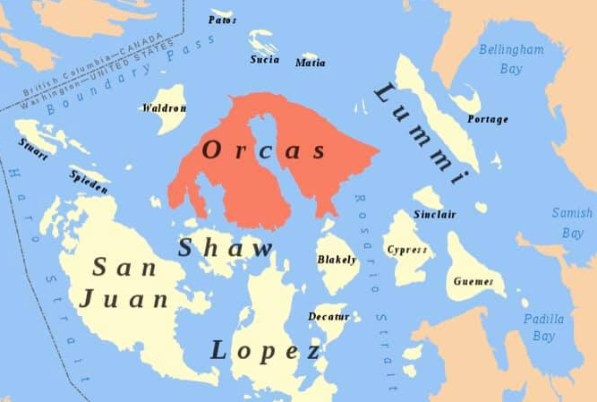
Above: Orcas Island
Our Vision Includes ...
- Ongoing training, education and drills for everyone, regardless of skills or physical abilities
- Preparing for individual and family self-sufficiency in critical areas such as food and water
- Developing communications networks using radio technologies such as FRS, GMRS and ham radio that could continue to function when cell towers and internet fail
- Creating mutually supportive relationships with other emergency response groups, sharing information, skills and resources
- Providing community support in the critical period before professional emergency responders arrive
- Empowering community members to safely and effectively assist professional responders (if and when requested!) by teaching essential skills such as fire safety, search and rescue, and medical operations, and organizing volunteers to handle tasks that free up first responders for more complex duties
Questions? Suggestions?
click Here
Radio Communications
Technologies such as Family Radio Service, General Mobile Radio Service, ham radio and satellite could continue to function when cell towers and internet fail. Free classes will cover both the how-to of using handheld radios and radio etiquette.We are a 501(c)(3) nonprofit. To view our IRS determination letter, please click HERE
Our Federal Employer Identification Number (EIN) is
41-4915343.
We are incorporated in Washington State (UBI 606 128 055).
Our Board:
Michael Hurwicz, President Michael is a Community Emergency Response Teams (CERT) program manager), a member of the San Juan County Amateur Radio Society, a former Boy Scout, a member of Orcas Odd Fellows, president of Irthlingz Arts-Based Environmental Education and founder of Let's Get Ready Orcas.
Sharon Abreu, Vice President Sharon is a 25-year resident of Orcas Island and executive director of IIrthlingz Arts-Based Environmental Education. Sharon's focus since 1993 has been the well-being of people through protection of water, air and forests. Her work is largely around engaging and inspiring people to become stewards of the Earth and to take action, individually and collectively, to respond to the climate crisis.
Jeffrey Beeman, Science Director Jeff is a retired materials scientist/engineer at Lawrence Berkeley National Laboratory and climate activist. Through his climate activism, Jeff is particularly focused on disasters connected to climate change, such as fires, floods, storms and heat waves.
Tycho Pendraig, Outreach Director
Based on Orcas Island, Tycho Pendraig is our Outreach Director. Tycho is an IT professional, radio technologist, educator, and futurist with a background in mechatronics engineering and accounting, and over a decade of experience out of the Silicon Valley/Bay Area.
Tycho serves as Technical Operations Coordinator for KIXP 102.3 FM on Orcas Island, and Co-Treasurer for Leadership San Juan Islands. Formerly a member of the Rotary Club of Marin Sunrise, serving two consecutive terms as President, Tycho is now proudly a member of the Rotary Club for Global Action; as well as being an LSJI alumni of Cohort XVII. Founder of Pendraig PNW, Tycho also teaches a variety of STEM classes at the Funhouse Commons including Technomages and Techno Minis, and offers a seasonal robotics workshop for adults called Technomaniacs. Tycho has presented at a handful of tech and leadership conferences including most recently at ToorCamp 2026.
When not occupied with work, Tycho dabbles in a host of hobbies including music creation, speculative fiction writing, nature photography, tech tinkering, baking, embroidery, archery, and hiking – to name but a few. For more information or to get in touch with Tycho, see here.